标签:线程 city image 1.0 取数 event [] key 列表


import requests
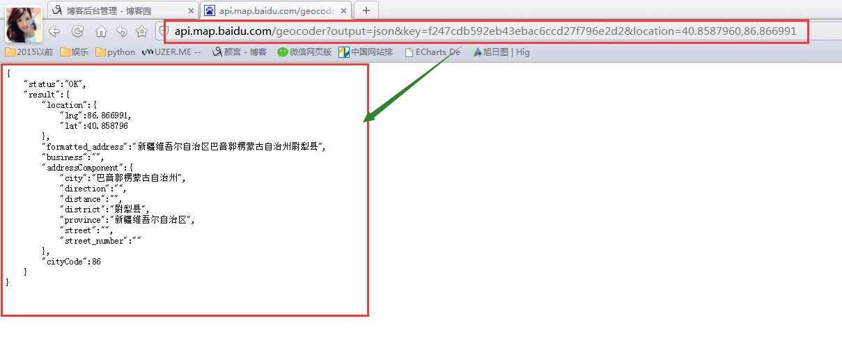
address = ‘40.8587960,86.866991‘
url = ‘http://api.map.baidu.com/geocoder?output=json&key=f247cdb592eb43ebac6ccd27f796e2d2&location=‘ + str(address)
response = requests.get(url)
answer = response.json()
print(‘得到反解数据‘, answer)
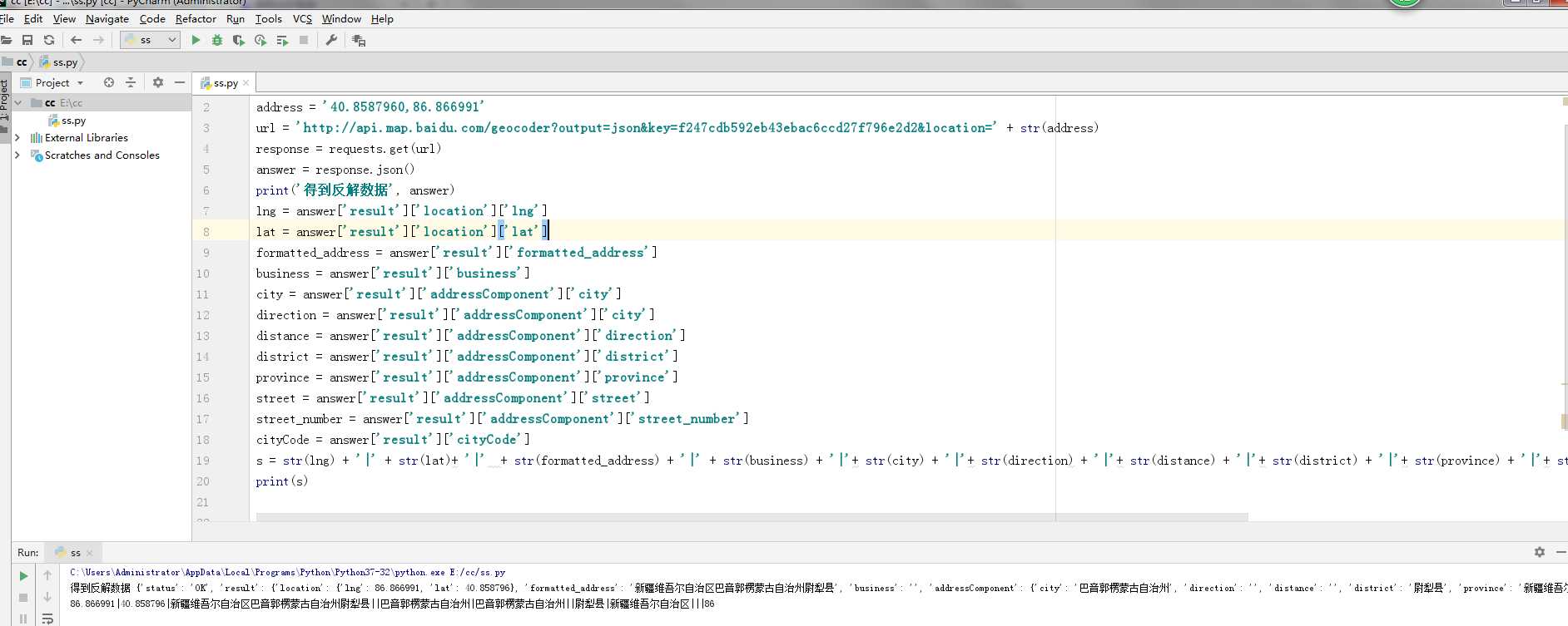

 1 import requests
 2 address = ‘40.8587960,86.866991‘
 3 url = ‘http://api.map.baidu.com/geocoder?output=json&key=f247cdb592eb43ebac6ccd27f796e2d2&location=‘ + str(address)
 4 response = requests.get(url)
 5 answer = response.json()
 6 print(‘得到反解数据‘, answer)
 7 lng = answer[‘result‘][‘location‘][‘lng‘]
 8 lat = answer[‘result‘][‘location‘][‘lat‘]
 9 formatted_address = answer[‘result‘][‘formatted_address‘]
10 business = answer[‘result‘][‘business‘]
11 city = answer[‘result‘][‘addressComponent‘][‘city‘]
12 direction = answer[‘result‘][‘addressComponent‘][‘city‘]
13 distance = answer[‘result‘][‘addressComponent‘][‘direction‘]
14 district = answer[‘result‘][‘addressComponent‘][‘district‘]
15 province = answer[‘result‘][‘addressComponent‘][‘province‘]
16 street = answer[‘result‘][‘addressComponent‘][‘street‘]
17 street_number = answer[‘result‘][‘addressComponent‘][‘street_number‘]
18 cityCode = answer[‘result‘][‘cityCode‘]
19 s = str(lng) + ‘|‘ + str(lat)+ ‘|‘  + str(formatted_address) + ‘|‘ + str(business) + ‘|‘+ str(city) + ‘|‘+ str(direction) + ‘|‘+ str(distance) + ‘|‘+ str(district) + ‘|‘+ str(province) + ‘|‘+ str(street) + ‘|‘+ str(street_number) + ‘|‘+ str(cityCode)
20 print(s)
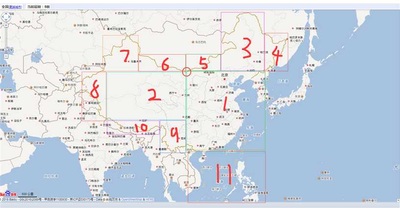
http://api.map.baidu.com/lbsapi/getpoint/index.html

 1 #鸡头1
 2 #129.000000,54.000000 #锚点(鸡头)
 3 #115.000000,54.0000000
 4 #115.000000,42.0000000  #北京
 5 #129.000000,42.000000 #沈阳
 6 #[‘54.0000000‘, ‘42.000000‘, ‘129.000000‘, ‘115.000000‘],#鸡头1
 7
 8 #鸡头2
 9 #129.000000,42.000000 #沈阳
10 #135.200000,42.000000
11 #129.000000,50.000000
12 #135.200000,50.000000
13    #[‘50.000000‘,‘42.000000‘,‘135.000000‘,‘129.000000‘],#鸡头2
14 #鸡头补充
15 #115.000000,42.0000000  #北京
16 #105.0000000,42.000000  #锚点(银川上面)
17 #105.0000000,45.500000 #乌兰巴托
18 #115.000000,45.500000
19 #[‘45.500000‘, ‘42.000000‘, ‘115.000000‘, ‘105.000000‘],#鸡头补充
20
21 #鸡屁股上补充
22 #105.0000000,42.000000  #锚点(银川上面)
23 #91.500000,45.500000  #乌鲁木齐
24 #105.0000000,45.500000  #乌兰巴托
25 #91.500000,42.000000 #锚点(鸡屁股)
26 #[‘45.500000‘, ‘42.000000‘, ‘105.0000000‘, ‘91.500000‘],#鸡屁股上补充
27 #鸡屁股上
28 #91.500000,42.000000 #锚点(鸡屁股)
29 #79.800000,42.000000 #啊拉木图
30 #79.800000,49.200000
31 #91.500000,49.200000
32 #[‘49.200000‘, ‘42.000000‘, ‘91.500000‘, ‘79.800000‘],#鸡屁股上
33 #鸡屁股下
34 #79.800000,42.000000 #啊拉木图
35 #79.800000,30.0000000 #巴雷利
36 #73.400000,42.000000
37 #73.400000,30.000000
38 #[‘42.000000‘, ‘30.000000‘, ‘79.800000‘, ‘73.400000‘],#鸡屁股下
39 #鸡下补充
40 #79.800000,30.0000000 #巴雷利
41 #97.300000,30.000000  #拉萨昌都(锚点)
42 #97.300000,26.800000
43 #79.800000,26.800000
44 #[‘42.000000‘, ‘30.000000‘, ‘97.300000‘, ‘79.800000‘],#鸡下补充
45 #鸡下
46 #97.300000,30.000000 #拉萨昌都(锚点)
47 #105.000000,30.000000 #(成都重庆贵阳)
48 #105.000000,21.000000 #河内
49 #97.300000,21.000000 #曼德勒
50 #[‘30.000000‘, ‘21.000000‘, ‘105.000000‘, ‘97.300000‘],#鸡下
51
52
53 #鸡胸
54 #105.0000000,42.000000  #锚点(银川上面)
55 #105.0000000,21.000000 #河内
56 #129.000000,42.000000 #沈阳
57 #129.000000,21.000000 #台北(海)
58 #[‘42.000000‘, ‘21.000000‘, ‘129.000000‘, ‘105.000000‘],#鸡胸
59
60 #鸡身
61 #105.000000,42.000000  #锚点(银川上面)
62 #79.800000,42.000000  #啊拉木图
63 #79.800000,30.000000 #巴雷利
64 #105.000000,30.000000  #(成都重庆贵阳)
65 #[‘42.000000‘, ‘30.000000‘, ‘105.000000‘, ‘79.800000‘],#鸡身
66 #鸡脚 (南海)
67 #105.000000,21.000000 #河内
68 #129.000000,21.000000 #台北(海)
69 #105.0000000,3.000000 #新加坡
70 #129.000000,3.000000 #海(苏拉威西海)
71 #[‘21.000000‘, ‘3.000000‘, ‘129.000000‘, ‘105.000000‘],
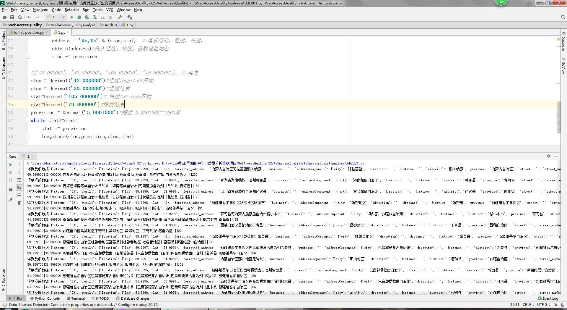

 1 import requests
 2 from decimal import Decimal
 3 def obtain(address):
 4     url = ‘http://api.map.baidu.com/geocoder?output=json&key=f247cdb592eb43ebac6ccd27f796e2d2&location=‘ + str(address)
 5     response = requests.get(url)
 6     answer = response.json()
 7     print(‘得到反解数据‘, answer)
 8     lng = answer[‘result‘][‘location‘][‘lng‘]
 9     lat = answer[‘result‘][‘location‘][‘lat‘]
10     formatted_address = answer[‘result‘][‘formatted_address‘]
11     business = answer[‘result‘][‘business‘]
12     city = answer[‘result‘][‘addressComponent‘][‘city‘]
13     direction = answer[‘result‘][‘addressComponent‘][‘city‘]
14     distance = answer[‘result‘][‘addressComponent‘][‘direction‘]
15     district = answer[‘result‘][‘addressComponent‘][‘district‘]
16     province = answer[‘result‘][‘addressComponent‘][‘province‘]
17     street = answer[‘result‘][‘addressComponent‘][‘street‘]
18     street_number = answer[‘result‘][‘addressComponent‘][‘street_number‘]
19     cityCode = answer[‘result‘][‘cityCode‘]
20     s = str(‘%6f‘ % lng) + ‘|‘ + str(‘%6f‘ % lat) + ‘|‘ + str(formatted_address) + ‘|‘ + str(business) + ‘|‘ + str(
21         city) + ‘|‘ + str(direction) + ‘|‘ + str(distance) + ‘|‘ + str(district) + ‘|‘ + str(province) + ‘|‘ + str(
22         street) + ‘|‘ + str(street_number) + ‘|‘ + str(cityCode)
23     print(s)
24
25 def longitude(slon,precision,elon,slat):
26     while slon >= elon:
27         address = ‘%s,%s‘ % (slon,slat)  # 请求用的,经度,纬度,
28         obtain(address)#传入经度,纬度,获取地址地名
29         slon -= precision
30
31 #[‘42.000000‘, ‘30.000000‘, ‘105.000000‘, ‘79.800000‘],  # 鸡身
32 slon = Decimal(‘42.000000‘)#经度longitude开始
33 elon = Decimal(‘30.000000‘)#经度结束
34 slat=Decimal(‘105.000000‘)# 纬度latitude开始
35 elat=Decimal(‘79.800000‘)#纬度结束
36 precision = Decimal(‘5.0001000‘)#精度 0.0001000==1000米
37 while slat>=elat:
38     slat -= precision
39     longitude(slon,precision,elon,slat)
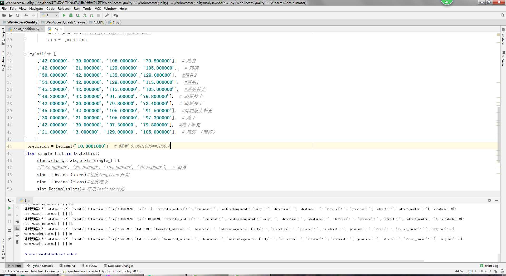

 1 import requests
 2 from decimal import Decimal
 3 def obtain(address):
 4     url = ‘http://api.map.baidu.com/geocoder?output=json&key=f247cdb592eb43ebac6ccd27f796e2d2&location=‘ + str(address)
 5     response = requests.get(url)
 6     answer = response.json()
 7     print(‘得到反解数据‘, answer)
 8     lng = answer[‘result‘][‘location‘][‘lng‘]
 9     lat = answer[‘result‘][‘location‘][‘lat‘]
10     formatted_address = answer[‘result‘][‘formatted_address‘]
11     business = answer[‘result‘][‘business‘]
12     city = answer[‘result‘][‘addressComponent‘][‘city‘]
13     direction = answer[‘result‘][‘addressComponent‘][‘city‘]
14     distance = answer[‘result‘][‘addressComponent‘][‘direction‘]
15     district = answer[‘result‘][‘addressComponent‘][‘district‘]
16     province = answer[‘result‘][‘addressComponent‘][‘province‘]
17     street = answer[‘result‘][‘addressComponent‘][‘street‘]
18     street_number = answer[‘result‘][‘addressComponent‘][‘street_number‘]
19     cityCode = answer[‘result‘][‘cityCode‘]
20     s = str(‘%6f‘ % lng) + ‘|‘ + str(‘%6f‘ % lat) + ‘|‘ + str(formatted_address) + ‘|‘ + str(business) + ‘|‘ + str(
21         city) + ‘|‘ + str(direction) + ‘|‘ + str(distance) + ‘|‘ + str(district) + ‘|‘ + str(province) + ‘|‘ + str(
22         street) + ‘|‘ + str(street_number) + ‘|‘ + str(cityCode)
23     print(s)
24
25 def longitude(slon,precision,elon,slat):
26     while slon >= elon:
27         address = ‘%s,%s‘ % (slon,slat)  # 请求用的,经度,纬度,
28         obtain(address)#传入经度,纬度,获取地址地名
29         slon -= precision
30
31 LogLatList=[
32     [‘42.000000‘, ‘30.000000‘, ‘105.000000‘, ‘79.800000‘],  # 鸡身
33     [‘42.000000‘, ‘21.000000‘, ‘129.000000‘, ‘105.000000‘],  # 鸡胸
34     [‘50.000000‘, ‘42.000000‘, ‘135.000000‘,‘129.000000‘],  #鸡头2
35     [‘54.000000‘, ‘42.000000‘, ‘129.000000‘, ‘115.000000‘],  #鸡头1
36     [‘45.500000‘, ‘42.000000‘, ‘115.000000‘, ‘105.000000‘],  #鸡头补充
37     [‘49.200000‘, ‘42.000000‘, ‘91.500000‘, ‘79.800000‘],  # 鸡屁股上
38     [‘42.000000‘, ‘30.000000‘, ‘79.800000‘, ‘73.400000‘],  # 鸡屁股下
39     [‘45.500000‘, ‘42.000000‘, ‘105.000000‘, ‘91.500000‘],  #鸡屁股上补充
40     [‘30.000000‘, ‘21.000000‘, ‘105.000000‘, ‘97.300000‘],  # 鸡下
41     [‘42.000000‘, ‘30.000000‘, ‘97.300000‘, ‘79.800000‘],  #鸡下补充
42     [‘21.000000‘, ‘3.000000‘, ‘129.000000‘, ‘105.000000‘],  # 鸡脚 (南海)
43    ]
44 precision = Decimal(‘10.0001000‘)  # 精度 0.0001000==1000米
45 for single_list in LogLatList:
46     slons,elons,slats,elats=single_list
47     #[‘42.000000‘, ‘30.000000‘, ‘105.000000‘, ‘79.800000‘],  # 鸡身
48     slon = Decimal(slons)#经度longitude开始
49     elon = Decimal(elons)#经度结束
50     slat=Decimal(slats)# 纬度latitude开始
51     elat=Decimal(elats)#纬度结束
52
53     while slat>=elat:
54         slat -= precision
55         longitude(slon,precision,elon,slat)
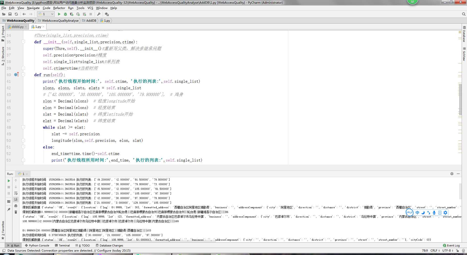

 1 import requests
 2 from decimal import Decimal
 3 import threading , time
 4 def obtain(address):
 5     url = ‘http://api.map.baidu.com/geocoder?output=json&key=f247cdb592eb43ebac6ccd27f796e2d2&location=‘ + str(address)
 6     response = requests.get(url)
 7     answer = response.json()
 8     print(‘得到反解数据‘, answer)
 9     lng = answer[‘result‘][‘location‘][‘lng‘]
10     lat = answer[‘result‘][‘location‘][‘lat‘]
11     formatted_address = answer[‘result‘][‘formatted_address‘]
12     business = answer[‘result‘][‘business‘]
13     city = answer[‘result‘][‘addressComponent‘][‘city‘]
14     direction = answer[‘result‘][‘addressComponent‘][‘city‘]
15     distance = answer[‘result‘][‘addressComponent‘][‘direction‘]
16     district = answer[‘result‘][‘addressComponent‘][‘district‘]
17     province = answer[‘result‘][‘addressComponent‘][‘province‘]
18     street = answer[‘result‘][‘addressComponent‘][‘street‘]
19     street_number = answer[‘result‘][‘addressComponent‘][‘street_number‘]
20     cityCode = answer[‘result‘][‘cityCode‘]
21     s = str(‘%6f‘ % lng) + ‘|‘ + str(‘%6f‘ % lat) + ‘|‘ + str(formatted_address) + ‘|‘ + str(business) + ‘|‘ + str(
22         city) + ‘|‘ + str(direction) + ‘|‘ + str(distance) + ‘|‘ + str(district) + ‘|‘ + str(province) + ‘|‘ + str(
23         street) + ‘|‘ + str(street_number) + ‘|‘ + str(cityCode)
24     print(s)
25
26 def longitude(slon,precision,elon,slat):
27     while slon >= elon:
28         address = ‘%s,%s‘ % (slon,slat)  # 请求用的,经度,纬度,
29         obtain(address)#传入经度,纬度,获取地址地名
30         slon -= precision
31
32
33 class Thre(threading.Thread):#继承线程中的类
34     #Thre(single_list,precision,ctime)
35     def __init__(self,single_list,precision,ctime):
36         super(Thre,self).__init__()#重新写父类,解决多继承问题
37         self.precision=precision#精度
38         self.single_list=single_list#单列表
39         self.ctime=ctime#当前时间
40     def run(self):
41         print(‘执行线程开始时间:‘, self.ctime, ‘执行的列表:‘,self.single_list)
42         slons, elons, slats, elats = self.single_list
43         # [‘42.000000‘, ‘30.000000‘, ‘105.000000‘, ‘79.800000‘],  # 鸡身
44         slon = Decimal(slons)  # 经度longitude开始
45         elon = Decimal(elons)  # 经度结束
46         slat = Decimal(slats)  # 纬度latitude开始
47         elat = Decimal(elats)  # 纬度结束
48         while slat >= elat:
49             slat -= self.precision
50             longitude(slon,self.precision, elon, slat)
51         else:
52             end_time=time.time()-self.ctime
53             print(‘执行线程所用时间:‘,end_time, ‘执行的列表:‘,self.single_list)
54
55 def main():
56     LogLatList=[
57         [‘42.000000‘, ‘30.000000‘, ‘105.000000‘, ‘79.800000‘],  # 鸡身
58         [‘42.000000‘, ‘21.000000‘, ‘129.000000‘, ‘105.000000‘],  # 鸡胸
59         [‘50.000000‘, ‘42.000000‘, ‘135.000000‘,‘129.000000‘],  #鸡头2
60         [‘54.000000‘, ‘42.000000‘, ‘129.000000‘, ‘115.000000‘],  #鸡头1
61         [‘45.500000‘, ‘42.000000‘, ‘115.000000‘, ‘105.000000‘],  #鸡头补充
62         [‘49.200000‘, ‘42.000000‘, ‘91.500000‘, ‘79.800000‘],  # 鸡屁股上
63         [‘42.000000‘, ‘30.000000‘, ‘79.800000‘, ‘73.400000‘],  # 鸡屁股下
64         [‘45.500000‘, ‘42.000000‘, ‘105.000000‘, ‘91.500000‘],  #鸡屁股上补充
65         [‘30.000000‘, ‘21.000000‘, ‘105.000000‘, ‘97.300000‘],  # 鸡下
66         [‘42.000000‘, ‘30.000000‘, ‘97.300000‘, ‘79.800000‘],  #鸡下补充
67         [‘21.000000‘, ‘3.000000‘, ‘129.000000‘, ‘105.000000‘],  # 鸡脚 (南海)
68        ]
69     precision = Decimal(‘20.0001000‘)  # 精度 0.0001000==1000米
70
71     thre_list=[] #线程列表
72     for single_list in LogLatList:
73         ctime=time.time()#当前时间
74         temp=Thre(single_list,precision,ctime)#实例化类
75         thre_list.append(temp)#线程列表
76     for thre in thre_list:#线程列表
77         thre.start()#执行单个线程
78
79 if __name__ == ‘__main__‘:
80     main()
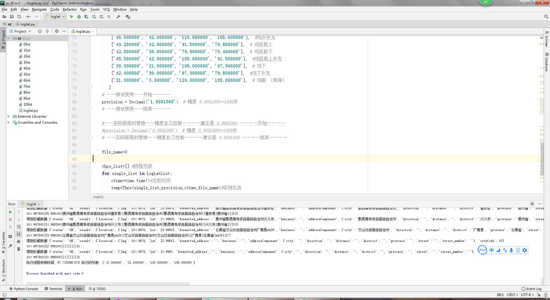

 1 import requests
 2 from decimal import Decimal
 3 import threading , time
 4 def obtain(address,file_name):
 5     url = ‘http://api.map.baidu.com/geocoder?output=json&key=f247cdb592eb43ebac6ccd27f796e2d2&location=‘ + str(address)
 6     response = requests.get(url)
 7     answer = response.json()
 8     print(‘得到反解数据‘, answer)
 9     lng = answer[‘result‘][‘location‘][‘lng‘]
10     lat = answer[‘result‘][‘location‘][‘lat‘]
11     formatted_address = answer[‘result‘][‘formatted_address‘]
12     business = answer[‘result‘][‘business‘]
13     city = answer[‘result‘][‘addressComponent‘][‘city‘]
14     direction = answer[‘result‘][‘addressComponent‘][‘city‘]
15     distance = answer[‘result‘][‘addressComponent‘][‘direction‘]
16     district = answer[‘result‘][‘addressComponent‘][‘district‘]
17     province = answer[‘result‘][‘addressComponent‘][‘province‘]
18     street = answer[‘result‘][‘addressComponent‘][‘street‘]
19     street_number = answer[‘result‘][‘addressComponent‘][‘street_number‘]
20     cityCode = answer[‘result‘][‘cityCode‘]
21     s = str(‘%6f‘ % lng) + ‘|‘ + str(‘%6f‘ % lat) + ‘|‘ + str(formatted_address) + ‘|‘ + str(business) + ‘|‘ + str(
22         city) + ‘|‘ + str(direction) + ‘|‘ + str(distance) + ‘|‘ + str(district) + ‘|‘ + str(province) + ‘|‘ + str(
23         street) + ‘|‘ + str(street_number) + ‘|‘ + str(cityCode)
24     print(s)
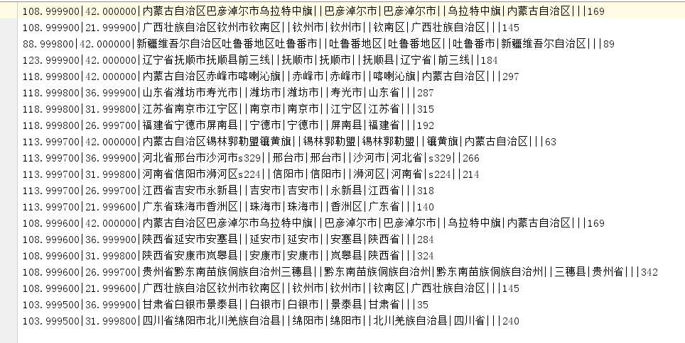
25     if cityCode==0:
26         #print(‘外国‘)
27         pass
28     else:
29         #print(s)
30         fname=str(file_name)+‘list‘
31         with open(fname, ‘a+‘, encoding=(‘utf-8‘)) as f:
32             f.write(s+‘\n‘)
33
34 def longitude(slon,precision,elon,slat,file_name):
35     while slon >= elon:
36         address = ‘%s,%s‘ % (slon,slat)  # 请求用的,经度,纬度,
37         obtain(address,file_name)#传入经度,纬度,获取地址地名
38         slon -= precision
39
40
41 class Thre(threading.Thread):#继承线程中的类
42     #Thre(single_list,precision,ctime)
43     #temp = Thre(single_list, precision, ctime, file_name)  # 实例化类
44     def __init__(self,single_list,precision,ctime,file_name):
45         super(Thre,self).__init__()#重新写父类,解决多继承问题
46         self.precision=precision#精度
47         self.single_list=single_list#单列表
48         self.ctime=ctime#当前时间
49         self.file_name=file_name#文件名
50     def run(self):
51         print(‘执行线程开始时间:‘, self.ctime, ‘执行的列表:‘,self.single_list)
52         slons, elons, slats, elats = self.single_list
53         # [‘42.000000‘, ‘30.000000‘, ‘105.000000‘, ‘79.800000‘],  # 鸡身
54         slon = Decimal(slons)  # 经度longitude开始
55         elon = Decimal(elons)  # 经度结束
56         slat = Decimal(slats)  # 纬度latitude开始
57         elat = Decimal(elats)  # 纬度结束
58         while slat >= elat:
59             slat -= self.precision
60             longitude(slon,self.precision, elon, slat,self.file_name)
61         else:
62             end_time=time.time()-self.ctime
63             print(‘执行线程所用时间:‘,end_time, ‘执行的列表:‘,self.single_list)
64
65 def main():
66     LogLatList=[
67         [‘42.000000‘, ‘30.000000‘, ‘105.000000‘, ‘79.800000‘],  # 鸡身
68         [‘42.000000‘, ‘21.000000‘, ‘129.000000‘, ‘105.000000‘],  # 鸡胸
69         [‘50.000000‘, ‘42.000000‘, ‘135.000000‘,‘129.000000‘],  #鸡头2
70         [‘54.000000‘, ‘42.000000‘, ‘129.000000‘, ‘115.000000‘],  #鸡头1
71         [‘45.500000‘, ‘42.000000‘, ‘115.000000‘, ‘105.000000‘],  #鸡头补充
72         [‘49.200000‘, ‘42.000000‘, ‘91.500000‘, ‘79.800000‘],  # 鸡屁股上
73         [‘42.000000‘, ‘30.000000‘, ‘79.800000‘, ‘73.400000‘],  # 鸡屁股下
74         [‘45.500000‘, ‘42.000000‘, ‘105.000000‘, ‘91.500000‘],  #鸡屁股上补充
75         [‘30.000000‘, ‘21.000000‘, ‘105.000000‘, ‘97.300000‘],  # 鸡下
76         [‘42.000000‘, ‘30.000000‘, ‘97.300000‘, ‘79.800000‘],  #鸡下补充
77         [‘21.000000‘, ‘3.000000‘, ‘129.000000‘, ‘105.000000‘],  # 鸡脚 (南海)
78        ]
79     # ——测试使用——开始————
80     precision = Decimal(‘1.0001000‘)  # 精度 0.0001000==1000米
81     # ——测试使用——结束————
82
83     #——实际获取时替换——精度自己控制————建议是 0.0001000 ————开始————
84     #precision = Decimal(‘0.0001000‘)  # 精度 0.0001000==1000米
85     # ——实际获取时替换——精度自己控制————建议是 0.0001000 ————结束————
86
87     file_name=0
88
89     thre_list=[] #线程列表
90     for single_list in LogLatList:
91         ctime=time.time()#当前时间
92         temp=Thre(single_list,precision,ctime,file_name)#实例化类
93         file_name+=1
94         thre_list.append(temp)#线程列表
95     for thre in thre_list:#线程列表
96         thre.start()#执行单个线程
97
98 if __name__ == ‘__main__‘:
99     main()
爬虫——python——百度地图经纬度查询——经纬度查看地点地名——利用百度API获取地名经纬度——爬取所有的中国地址
标签:线程 city image 1.0 取数 event [] key 列表
原文地址:https://www.cnblogs.com/ujq3/p/9775376.html