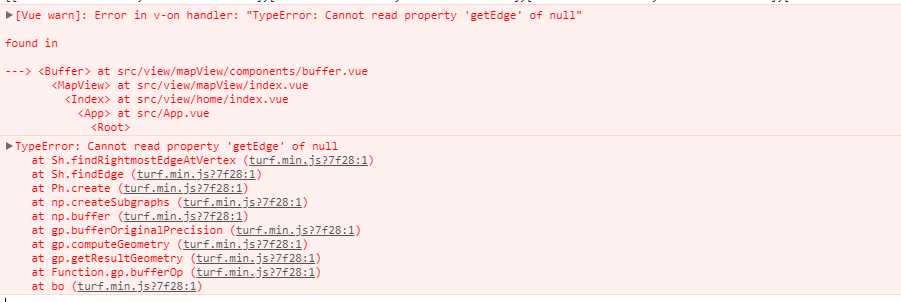
标签:article 读取 文档 this point cto class task 实现
      var line = turf.lineString([[8940117.74537665,5936319.233970245],[10407708.688452033,5740640.441560194],[10466412.326175049,5359066.796360594]]);
      var buffered = turf.buffer(line , val, {units: ‘kilometers‘});
      //创建数据geojson对象和数据源对象
      var format = new GeoJSON();
      var source = new VectorSource({ wrapX: false });
      // //读取geojson数据
      var lineFeature  = format.readFeature(line);
      var bufferFeature = format.readFeature(buffered);
      // //将数据添加数据源的
      source.addFeature(lineFeature);
      source.addFeature(bufferFeature);
      var test = new VectorLayer({ source: source })
      this.map.addLayer(test)

      let coordinates = ‘[[8940117.74537665,5936319.233970245],[10407708.688452033,5740640.441560194],[10466412.326175049,5359066.796360594]]‘;
      let bufferCoordinates = [],pointTransform=[];
      for (var i = 0; i < coordinates.length; i++) {
          pointTransform = transform(coordinates[i], "EPSG:3857", "EPSG:4326");
          bufferCoordinates.push(pointTransform);
        }
        var line = turf.lineString(bufferCoordinates);
        var buffered = turf.buffer(line , val, {units: ‘kilometers‘});
      //创建数据geojson对象和数据源对象
      var format = new GeoJSON();
      var source = new VectorSource({ wrapX: false });
      // //读取geojson数据
      var lineFeature = format.readFeature(line);
      var bufferFeature = format.readFeature(buffered);
      // //将数据添加数据源的
      source.addFeature(lineFeature);
      source.addFeature(bufferFeature);
      var test = new VectorLayer({ source: source })
      this.map.addLayer(test)
lineFeature.getGeometry().transform(‘EPSG:4326‘, ‘EPSG:3857‘);
bufferFeature.getGeometry().transform(‘EPSG:4326‘, ‘EPSG:3857‘);
再次运行,成功出现缓冲区:

标签:article 读取 文档 this point cto class task 实现
原文地址:https://www.cnblogs.com/KoKoLi/p/12745554.html